Die heutige Etappe beginnen wir mit einer schönen Wanderung über die Lenzerheide, gefolgt vom Abstieg nach Tiefencastel.
Sehens- & Wissenswertes
| Km 5 | Lenz (Lantsch auf rätoromanisch) war bereits in der älteren Eisenzeit besiedelt war. Siedlungsüberreste aus dem 1. Jh v. Chr. stammen vermutlich von einer keltischen Wachstation. Die Römer benutzten den Übergang Lenzerheide für ihre Truppen und Händler als Durchgangsroute zum Julier– und Septimerpass. In karolingischer Zeit gab es in Lenz einen Königshof, eine Kirche und zwei Herbergen.
Im Jahr 831 wird die Kirche St. Maria erstmals erwähnt. Ab Lenz/Lantsch bis über den Septimerpass spricht man grundsätzlich räto-romanisch, aber die meisten Einwohner verstehen und sprechen deutsch. |
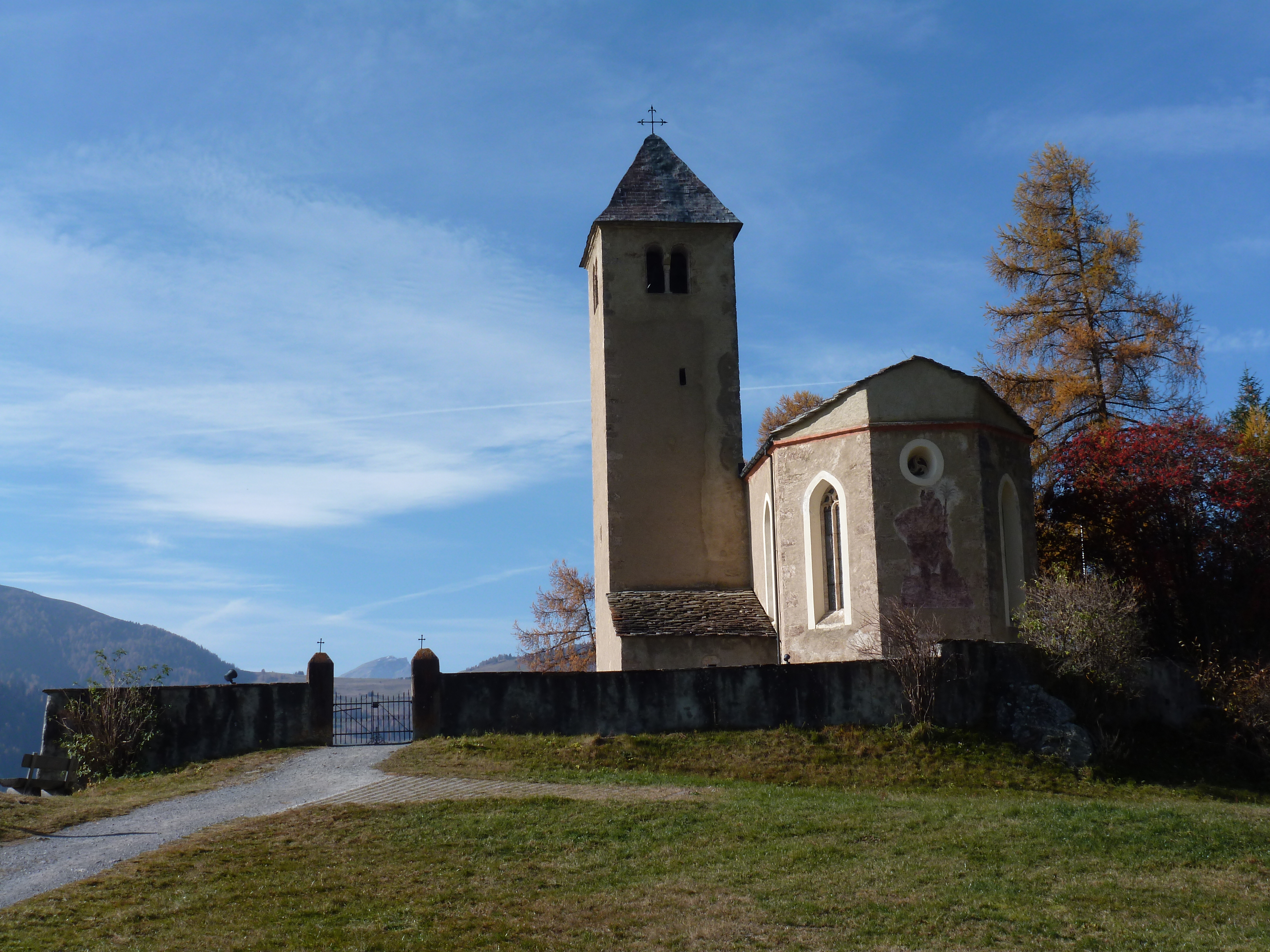
| Km 7 | In St. Peter Mistail steht die einzige unverbaute karolingische Dreiapsidenkirche der Schweiz. Man vermutet die Entstehung um das Jahr 800 aufgrund einer Erwähnung in einem Brief aus dem Jahr 823. Erstmals urkundlich erwähnt wird das Kloster 926 in einer Schenkungsurkunde Heinrichs I. Es wird vermutet, dass die Gründung von Mistail vom Kloster Cazis im Domleschg ausging.
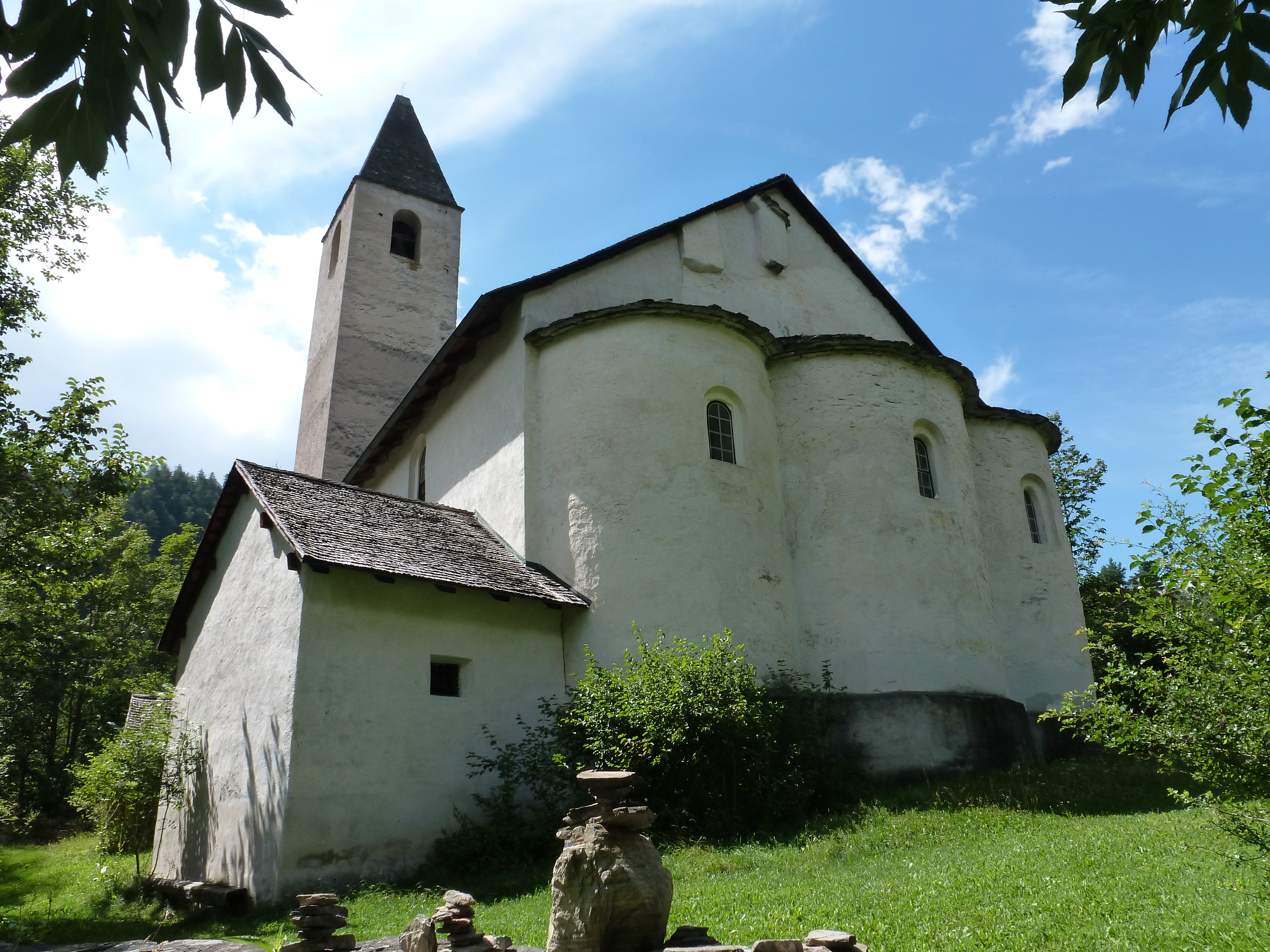
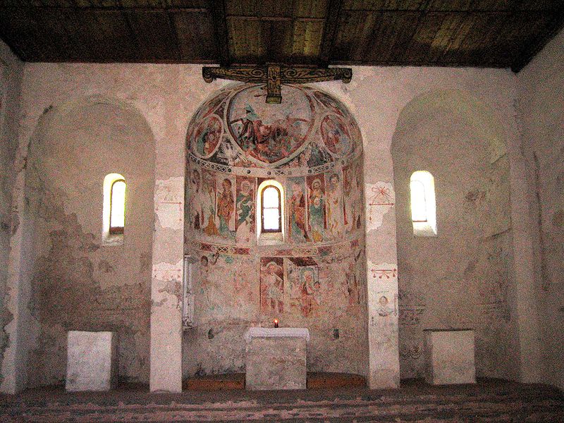
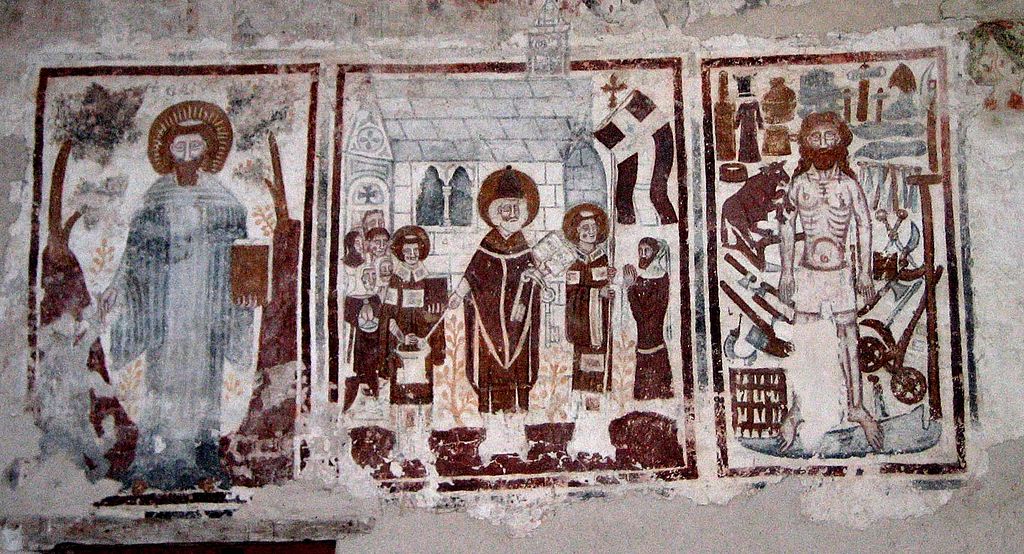
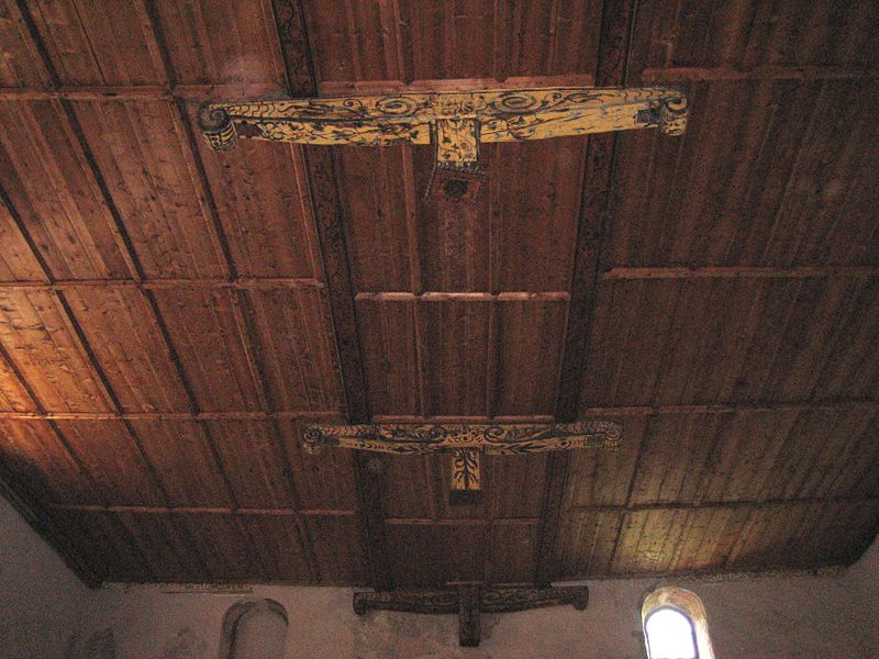
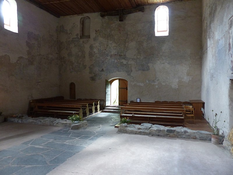
Eine Besichtigung ist unbedingt zu empfehlen. |
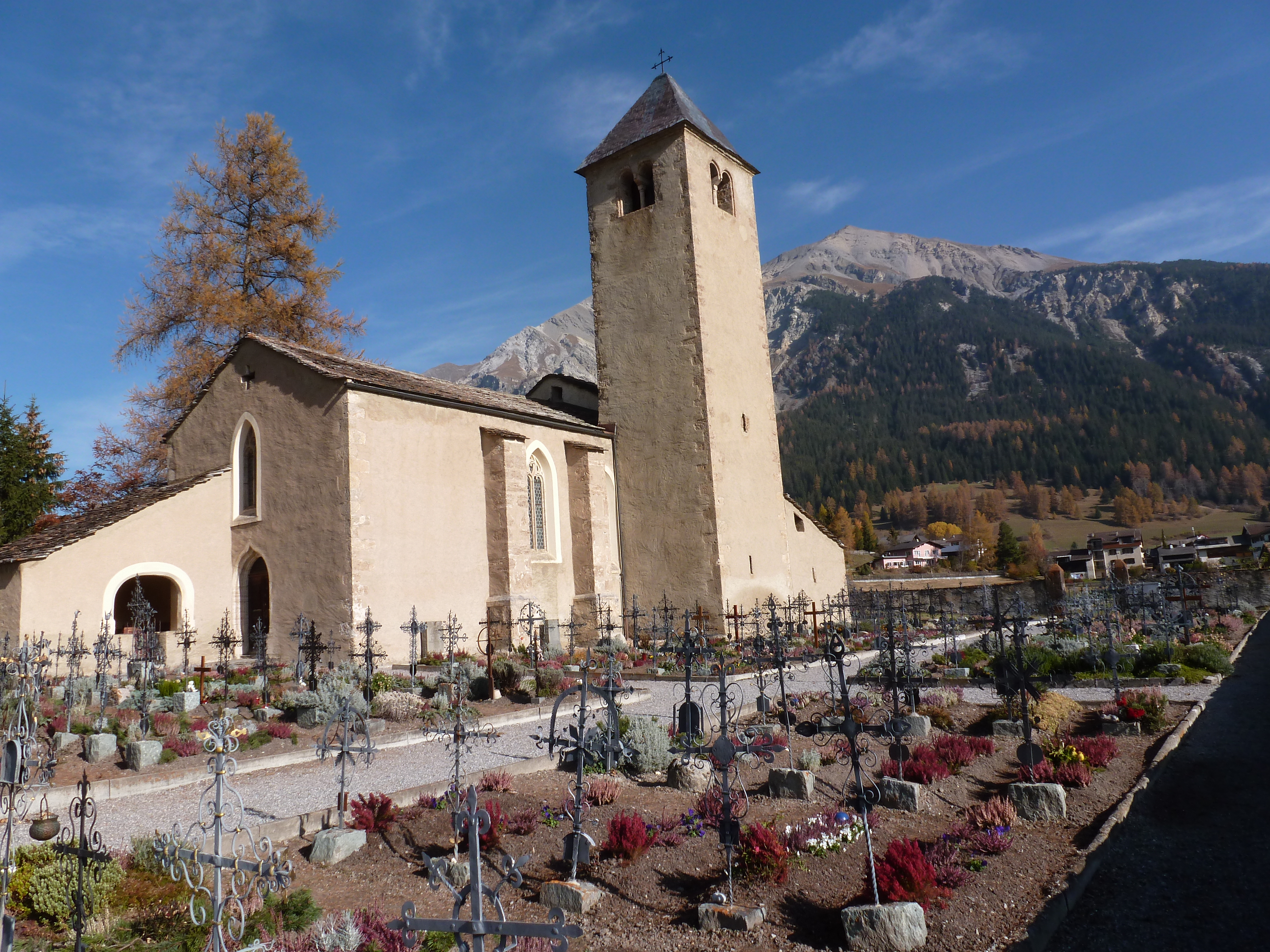
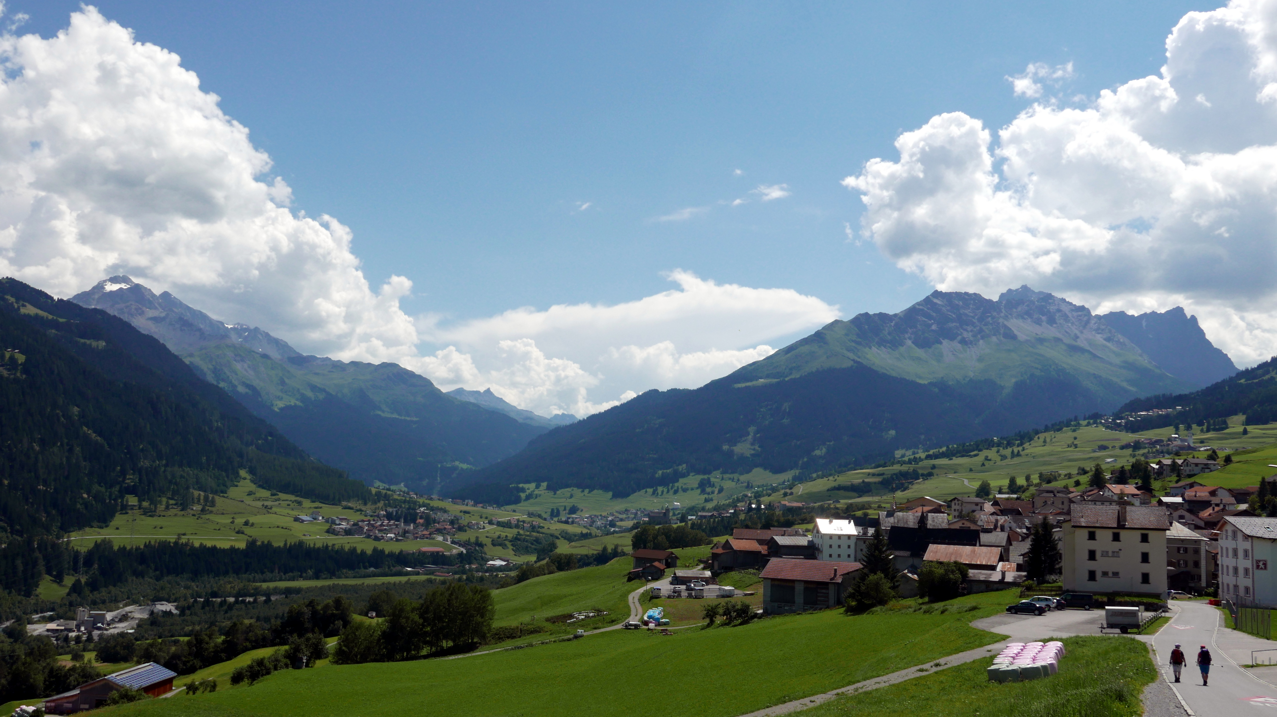
| Km 12 | Tiefencastel. Im Jahre 831 wurde Tiefencastel erstmals erwähnt als Sitz des königlichen Verwalters. Auf dem Hügel Plattas lag eine bronzezeitliche Siedlung und auf dem Kirchenhügel das römische Kastell. Archäologische Funde bestätigen die vorchristliche Besiedlung. Im Frühmittelalter war Tiefencastel eine befestigte Siedlung und im Mittelalter besass der Ort gar eine Zollbrücke. Ab 960 war Tiefencastel bischöfliches Herrschaftsgebiet.
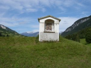 Beim heutigen Bildstock an der Julierstrasse oberhalb des Dorfes stand die im 6./7. Jh erbaute Kapelle St. Ambrosius. Verkehrstechnisch hatte Tiefencastel schon immer eine grosse Bedeutung, denn der Ort liegt an der Transitachse über den Septimer- und Julierpass. Die Septimerpassstrasse nach Chiavenna war über Jahrhunderte die wichtigste Verkehrsachse zur Überquerung der Alpen. Ab Tiefencastel führt auch die Flüela-Passstrasse ins Engadin. |
| Km 18.5 | Salouf. Die erste bronzezeitliche Siedlung entstand um 2100 v. Chr. auf einer weithin sichtbaren Hügelkuppe, auf der Nordseite des heutigen Dorfes. Ebenfalls nachgewiesen wurden römische Siedlungsreste aus dem 1. Jh n. Chr. Im Mittelalter bestand wohl eine rätoromanische Siedlung beim heutigen Weiler Del. Als gegen Ende des 13. Jh die ersten deutschsprachigen Walser durch das Tal zogen, liessen sie sich wie für die Walser typisch, hauptsächlich in der oberen Talhälfte und den Seitentälern nieder
Ab Salouf verlassen wir die Via Sett (64) und wandern der Strasse entlang nach Cunters und Savognin. Damit ersparen wir uns einen längeren Auf- und Abstieg. Ab Savognin geht es dann wieder auf der Via Sett weiter. |
| Km 25 | Savognin. Auf dem Hügel südlich des Ortes lag eine bedeutende Siedlung der Bronzezeit. Fundstücke belegen Dorfanlagen aus verschiedenen Epochen, etwa zwischen 1800 und 1000 v. Chr.
Erst ab 1960 begann der Aufstieg zum Fremdenverkehrsort, wobei der Bau von Hotels, Ferienwohnungen und Seilbahnen das Ortsbild nachhaltig veränderte. Savognin wurde 1978 bekannt durch die erstmalige grossflächige Verwendung von Schneekanonen. |