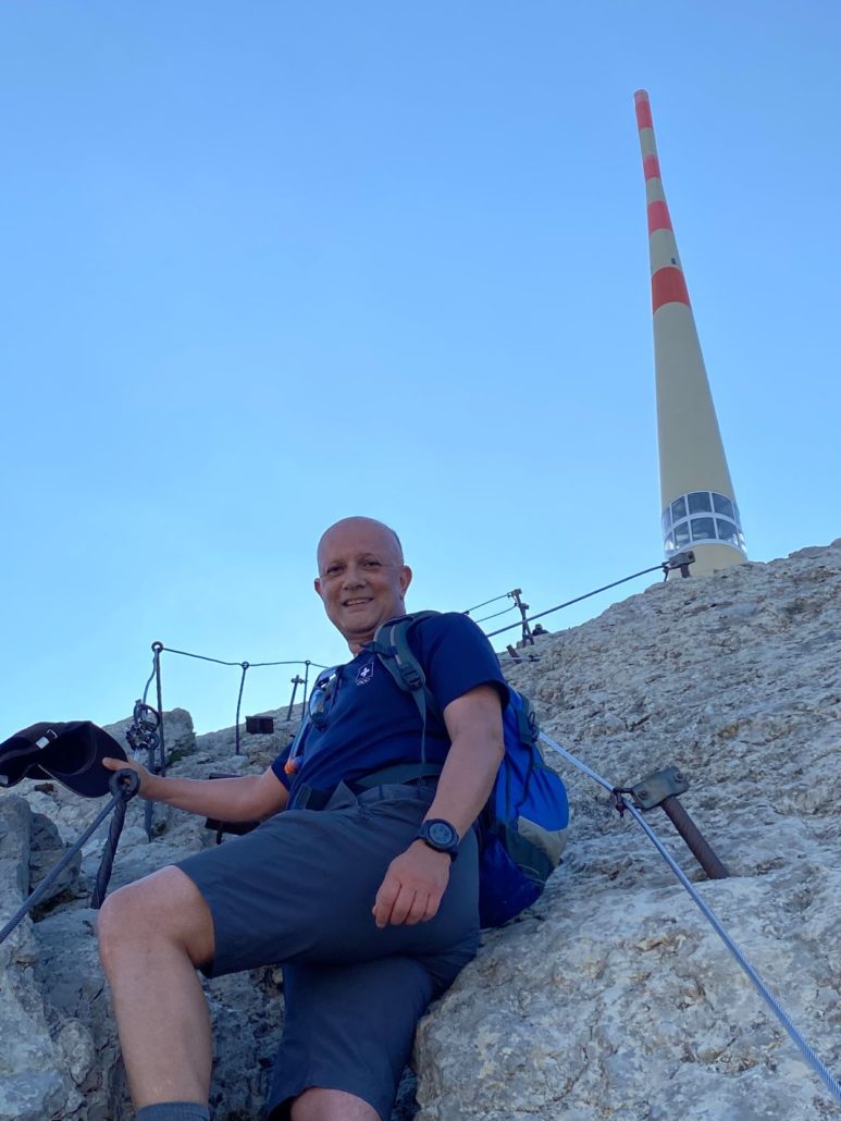
Welcome to the Swiss section of the European Columban Cultural Route Via Columbani. I am your hiking companion. I look forward to hiking with you on this piece from Basel to Chiavenna. I will draw your attention to all sorts of interesting and worth knowing things.
First of all, I will introduce you to hiking trail signaling in Switzerland.
The signpost explains
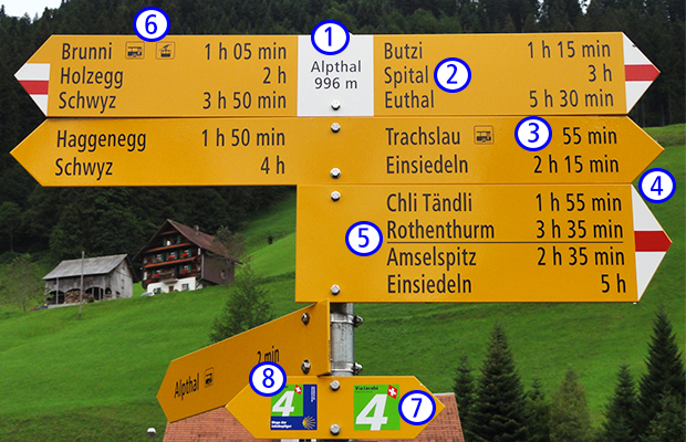
1. Current location and height above sea level
2. Hiking destinations
If several destinations can be reached in the same direction, the closest ones are listed at the top.
3. Hiking time (without breaks)
You can find times at all starting and ending points as well as intermediate destinations on a hiking route. Direction signs (i.e. signposts without destination information) are used to find directions when there are branches and have no time information.
4. Route category
The level of difficulty of a path is clearly visible thanks to the signaling: There are hiking trails (yellow) and mountain hiking trails (white-red-white).
5. Hyphen
If there is a route junction later, this is indicated with a hyphen.
6. Symbols
On the signposts and directional signs, they point the way to public transport, a viewpoint, a barbecue area or a restaurant.
7. Direction pointers / intermediate markings (see examples below)
These signposts without destination and time information (only yellow signs) can be provided with a pictogram (e.g. hiking) and can be found wherever the further route is otherwise unclear. They are supplemented by the so-called «confirmations» (white-red-white markings, yellow arrows).
8. Green stickers with numbers and route names
They are installed along particularly attractive hiking trails.
Intermediate markings
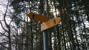
Intermediate markings guide hikers between the signpost locations. They provide information about the route and the category of the route section.
Direction pointer
 The white-red-white markings confirm the way and the correct orientation of the signposts, but are not indicative. The yellow rhombuses also serve this purpose
Markings
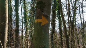
Markings are confirmations painted on stone blocks, trees, walls, posts and the like, as well as painted direction arrows.
On our hike we will find the green stickers with numbers and route names (see 8. above) for the following routes:
No. 60 Via Rhenana (our hike from Basel to Koblenz)
No. 4 Via Jacobi (the blue border shows the direction to Santiago, without blue border the way back), on our hike from Pfäffikon-Rapperswil-Wattwil, from Tuggen to Wattwil and from Herisau to St. Gallen to the cathedral. We follow the direction without a blue border
No. 64 Via Sett (our hike from Chur via Lenzerheide and Septimer to Castasegna / Chiavenna)
For the remaining routes, we follow the yellow signs as mentioned above.
Public transport
The public transport network in Switzerland is very dense and there are practically every place train and / or bus connections to the next place. Timetables can be found at www.sbb.ch/de/fahrplan.html. Buses and trains run almost everywhere every hour. This means that a stage can be shortened and the next stage can be reached by bus or train.
There is also a very good offer of public transport in Austria: http://fahrplan.oebb.at/bin/query.exe/dn.